May the Weather Be With You

June 4, 2019

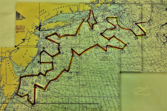
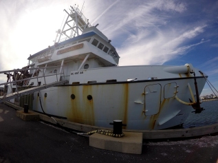
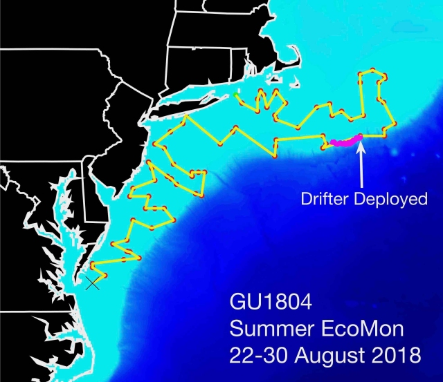
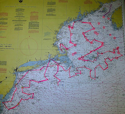
The oft quoted line “May the force be with you” should be paraphrased as “May the weather be with you” for our now almost completed spring Ecosystems Monitoring Survey!  We have been blessed by calm seas and light winds for almost every day of this trip, and as a result have now completed sampling coverage on all of Georges Bank and nearly every station in the expansive Gulf of Maine area as well.

Scientific Seawater Analysis System rd

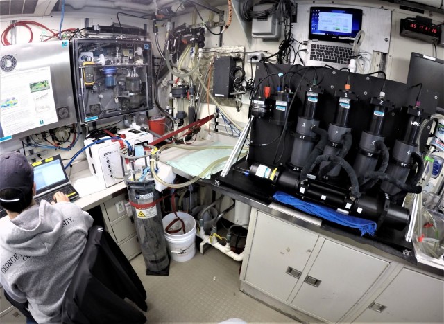
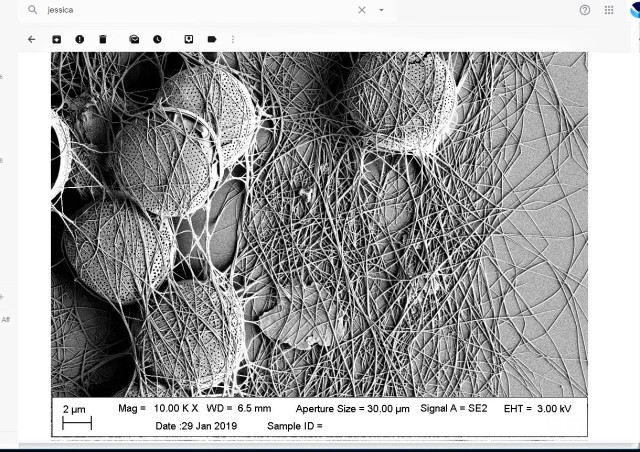
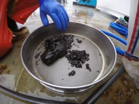
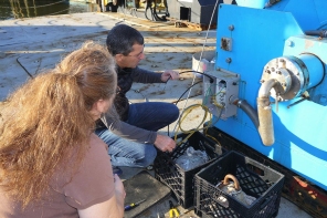
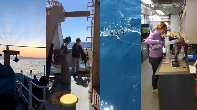
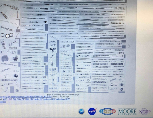
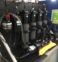
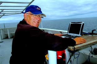
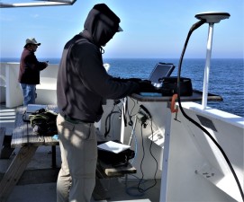
The scientific seawater analysis system on this cruise includes sensors to measure carbon dioxide (NOAA), total alkalinity (UNH), optical properties (URI), and record imagery of phytoplankton (WHOI). All this data is gathered from surface water pumped in along the entire cruise track. Photo credit: NOAA Fisheries/Jerry Prezioso

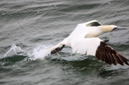
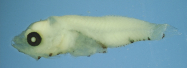
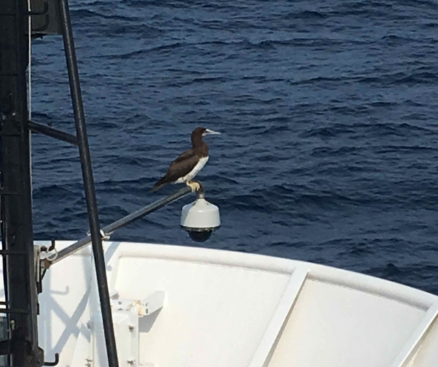
As mentioned in previous updates, the Ecosystem Monitoring Surveys attempt to serve as a vehicle for collecting data on many different fronts, from plankton to hydrography to seabirds and marine mammals, ocean water chemistry and optical properties, educational outreach and testing the efficacy of collecting gear.

Observers rd

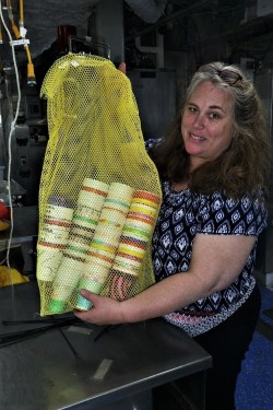
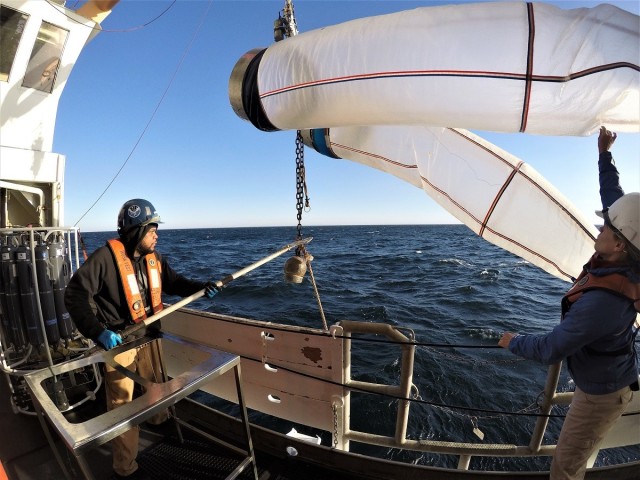
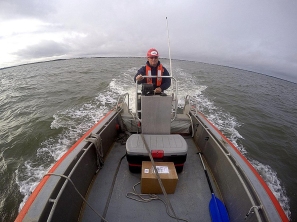
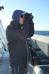
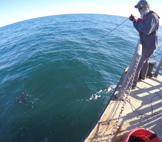
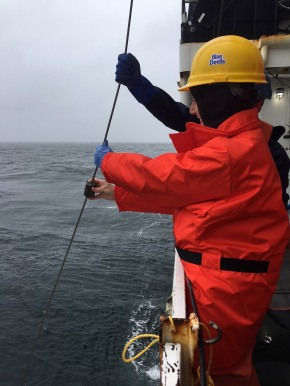
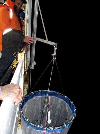
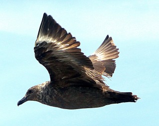
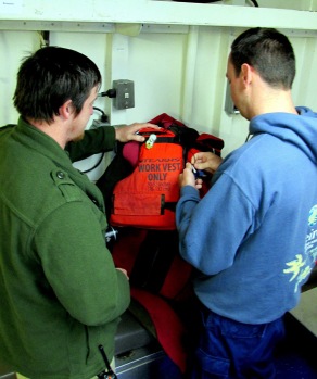
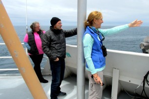
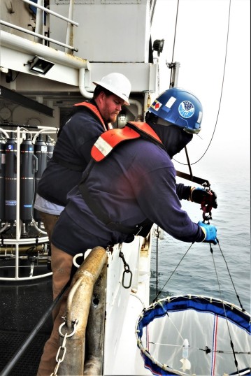
Above:  Observers John Loch and Nick Metheny spent hours everyday on the flying bridge of the Henry B. Bigelow. Their observations of seabirds and marine mammals were interrupted only by fog banks, not bad weather! Right:  Bigelow crew members Aaron Walton and Stephen Crawford deploy a ring net plankton sampler. Photo credits: NOAA Fisheries/Jerry Prezioso

RingNetAaronSteve rd

This cruise, aided by good weather and a unique combination of scientific staff and equipment, has succeeded on all these fronts, and will return home with loads of data and samples collected during our sixteen days at sea.

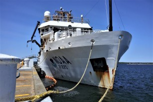
However, behind the scenes there is another component to the scientific achievements of this cruise: the often unheralded support provided by the vessel and its crew.  Working together, the NOAA officers, engineers, deck crew, survey and electronics specialists all collaborate to make the Henry B. Bigelow the best platform possible for achieving its scientific mission.  Without them the scientists couldn’t accomplish their around the clock, 24/7 routine of data collection in the relative comfort of what can often be a very inhospitable environment; the open ocean.

HB1902 Danielle Mission Control rd2

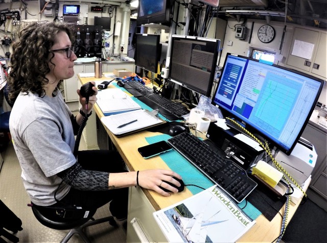
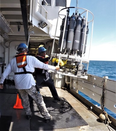
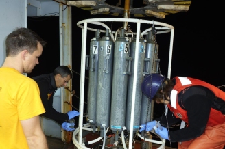
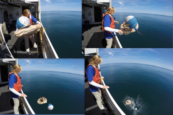
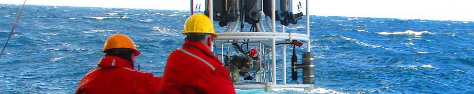
Survey tech Danielle Power monitors output from sensors during a CTD Niskin bottle water cast. Photo credit: NOAA Fisheries/Jerry Prezioso

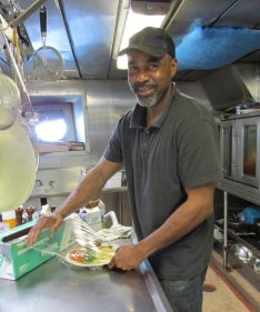
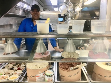
Even spending Memorial Day weekend aboard on this cruise away from family and friends was made less of a burden by the efforts of the stewards to create a sense of community with their chili nacho nights,  ice cream socials on Sundays and smoked beef brisket and pulled pork dinners made with their own on-board smoker!

Ray & Dennis in Galley ed rd

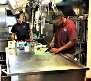
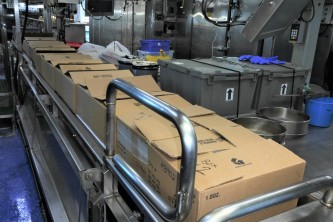
Stewards Dennis Carey and Raymond Burgess in the galley of the Henry B. Bigelow preparing one of their many excellent meals! Photo credit: NOAA Fisheries/Jerry Prezioso

Together with the rest of the scientific staff I’d like to thank everyone aboard the Henry B. Bigelow for enabling us to come home not just with a lot of data and samples, but also some fond memories and experiences from our time at sea.  Thank you all very much!

Jerry Prezioso
Chief Scientist
HB1902 Spring Ecosystem Monitoring Survey

Bongos, Barnacles and Boyle’s Law

May 29, 2019

Today marks one week into the voyage of the Henry B. Bigelow Spring Ecosystem Monitoring Survey, also known as EcoMon, and we have covered a lot of ground, literally, since our last update.  Now we have completed 60 stations as we move onto Georges Bank for the northern portion of our survey.  Aided by very good weather, we’ve been able to make good progress, and the sampling has proceeded smoothly with no stations missed from our truncated cruise plan.

Our plankton catches have been light, unencumbered by any algae blooms, thankfully unlike our plankton tows from last fall which were often dominated by dense blooms of a diatom, Thalassiosira mala, that coated our nets with a green mesh-plugging slime!

Thalassiosira mala

Scanning electron micrograph of the diatom Thalassiosira mala that bloomed off the coast of Southern New England in the fall of 2018. Photo credit: Dr. Lucie Maranda, URI/GSO

Fish larvae from the Mid-Atlantic Bight and Southern New England waters have been sparse.  We have a student on board, Quentin Nichols, who has been retrieving fish larvae from one of the bongo plankton nets, but has met with only modest success from the tows he has examined in the southern part of the survey.

Quentin Micro rd

Quentin Nichols from the NEFSC’s Narragansett Lab at his microscope aboard the FSV Henry B. Bigelow. Photo credit: NOAA Fisheries/Jerry Prezioso

Quentin Flatfish2

A flatfish larva collected from the bongo plankton sampler by Quentin Nichols. Photo credit: NOAA Fisheries/Quentin Nichols

Sometimes we do encounter rather unusual “planktonic” finds.  One tow had two colonies of gooseneck barnacles which had attached themselves to two fragments of buoyant plastic that were scooped up by our bongo nets.  It was ironic to find pieces of plastic, one of today’s greatest threats to the ocean ecosystem, providing a habitat for some organisms.

Gooseneck barnacles2 rd2

Gooseneck barnacles collected from the bongo nets. Photo credit: NOAA Fisheries/Jerry Prezioso

Ecosystem monitoring cruises from the Oceans and Climate Branch of the Northeast Fisheries Science Center collaborate with other institutions to conduct joint research while underway.  In addition, there is often an outreach component, usually in the form of a NOAA Teacher-at-Sea candidate who will sail with us to assist in deploying gear and recording data.  In our case a teacher wasn’t available to join us, but we do have representation from some young students in the form of hand-decorated Styrofoam cups.

HB1902 CUPS & Tamara

Tamara Holzwarth-Davis from the NEFSC’s Woods Hole Laboratory holds a mesh bag full of Styrofoam cups from 4th graders at Springbrook Elementary School. Photo credit: NOAA Fisheries/Jerry Prezioso

Fourth graders from the Springbrook Elementary School in Westerly, Rhode Island, have given us 60 of these cups to take out to sea.  Placed in a mesh bag and attached to our Niskin bottle rosette, they will provide an excellent

DCIM100GOPROGOPR2139.

Anthony Johnson and Jonathan Harvey retrieve the Niskin bottle rosette sampler with attached yellow mesh bag full of Styrofoam cups. Photo credit: NOAA Fisheries/Jerry Prezioso

demonstration of Boyle’s Law for the students as they shrink from repeated submersion with the sampling array as it’s lowered to the sea floor to collect water samples and hydrographic data.  These cups, now already a fraction of their original size, will be returned to the students after we disembark on June 6 as mementos of their class’s sea-pressure project!

HB1902 May29 TRAK2 rd

Cruise track of the HB 1902 EcoMon Survey as of the morning of May 29, 2019. Photo credit: NOAA Fisheries/Jerry Prezioso

Now with one week left to this survey we are planning a route that will take us across Georges Bank and through the Gulf of Maine, sampling as many stations as we can reach in the time remaining.  What has been unusual compared to surveys at other times of the year is that the weather has been consistently good, and is forecast to remain so for the near future, which certainly makes planning a lot easier!
Jerry Prezioso
Chief Scientist
HB 1902 Spring Ecosystem Monitoring Survey

From fish to plankton, hydrography and water chemistry

On a sunny afternoon on May 22 at 1400 hours, the FSV Henry Bigelow set sail from Naval Station Newport to embark on the 2019 Spring Ecosystem Monitoring Survey, conducted by the Oceans and Climate Branch of the Northeast Fisheries Science Center (NEFSC).  As is typical for these surveys, there are a number of objectives. Eight scientists are aboard from several different disciplines, conducting a variety of missions to collect data and samples from the shelf waters off the northeast U.S. coast.

HB 1902 Bigelow2 rd

FSV Henry B. Bigelow at Pier 2 of Naval Station Newport, just prior to sailing. Photo credit: NOAA Fisheries/Jerry Prezioso

Unlike the bottom trawl surveys, where the focus is on processing fish from the trawl catches, here we are concentrating on plankton sampling, hydrography and water chemistry, so the fish lab has become our storage area, while the CTD and chemistry labs are packed with a variety of analytical equipment and computers.  Quite a change for the vessel!

HB1902 Wetlab Storage3 rd

The Bigelow Fish Processing Lab has become the storage area for sampling gear and supplies. Photo credit: NOAA Fisheries/Jerry Prezioso

Now, on our third day of the voyage, we have completed fifteen stations, collecting plankton samples south of Narragansett Bay and west and south towards the coast of New Jersey with our bongo nets.  All along the cruise track water is being continuously pumped into the CTD lab and sampled and analyzed for CO2 levels, total alkalinity and optical properties, while video images of phytoplankton in the water are being recorded.

HB1902 CTD Lab Kyle rd

The CTD Lab on the Bigelow is now also filled with a variety of analytical equipment to monitor CO2, total alkalinity, optical properties and record images of phytoplankton from the seawater that is pumped in by the Scientific Seawater System while the ship is underway. Photo credit: NOAA Fisheries/Jerry Prezioso

DCIM100GOPROGOPR2129.

Deck hands Lindsey Houska (right) and Aaron Walton retrieving the plankton bongo nets after a sampling tow. Photo credit: NOAA Fisheries/Jerry Prezioso

The trip was punctuated with a previously scheduled calibration of the vessel’s computer-controlled Dynamic Positioning System, which automatically maintains a vessel’s position and heading by using its own propellers and thrusters, in Narragansett Bay. It took up a large part of our second day, but the command and crew are working hard to make up for that time.  We are now running smoothly on a course which should take us just beyond Delaware Bay for the southern portion of this trip. Good weather is helping too!

Jerry Prezioso
Chief Scientist
HB 1902 Spring Ecosystem Monitoring Survey

“The Little Ship That Could”

Nov. 12, 2018,

The Hugh R. Sharp left a sheltered anchorage behind Sandy Hook, New Jersey on Saturday night to continue sampling on the Fall Ecosystem Monitoring Survey for the Northeast Fisheries Science Center. We were forced in there on Friday by increasing winds and seas coming from the south, offering no lee for working along the southern shore of Long Island where we had hoped to conduct sampling for the Southern New England area of this trip. When a window of good weather window opened on Sunday and Monday, we grabbed that opportunity to conduct as much sampling as possible before returning to Woods Hole.

The weather has been our biggest challenge. Earlier on, it forced us to duck into Norfolk, VA to shelter from unworkable weather. While there we obtained a part for our winch which arrived after we had left port to return to work.

DCIM100GOPROGOPR2038.

Tim North using the Sharp‘s launch to pick up the winch part in Norfolk harbor. Photo by NOAA Fisheries/Jerry Prezioso

By launching a small boat the captain enabled us to retrieve the part, which was literally handed off to us at the dock, saving us a great deal of time. Moderating weather allowed us to work our way northward towards Southern New England waters until we were once again forced to heave to, this time in the Sandy Hook anchorage. Now on Monday, we find ourselves making excellent progress as we move further east around Nantucket Shoals where we will complete our survey before coming in to Woods Hole early on Tuesday morning, November 13, ahead of the next big storm system.

bongo-deployment-1-rd

Maura Thomas and Chris Taylor deploying the bongo plankton net array from the stern of the R/V Sharp. Photo credit: NOAA Fisheries/ Jerry Prezioso

As is typical for Ecosystem Monitoring Surveys, there are many lines of research being pursued while we are underway. Plankton tows and hydrographic-CTD water casts provide information on physical and biological aspects of the waters we are sailing through. The water column has been pretty well mixed in terms of temperatures and salinities, which is not surprising given the time of year and the numerous storms which have been roiling the waters almost incessantly.

We’ve seen flatfish larvae in many of the plankton samples taken in the Mid-Atlantic Bight area, despite often being buried in large numbers of salps. There have also been juvenile fish, possibly hake, in some of these samples, and in the Southern New England area we are seeing herring larvae at some stations.

More recently, a bloom of a reddish brown phytoplankton has been overwhelming everything else in our plankton samples.  It first appeared in the northern Mid-Atlantic Bight area and has persisted through most of our Southern New England stations,

DCIM100GOPROGOPR2078.

Our plankton nets were covered with this slimy phytoplankton coating on many tows in the Mid-Atlantic Bight and Southern New England. Photo credit: NOAA Fisheries/ Jerry Prezioso

DCIM100GOPROGOPR2080.

The phytoplankton formed clumps when washed into our collecting sieves.   Photo credit: NOAA Fisheries/Jerry Prezioso

(although not south of Nantucket Shoals) coating the plankton nets with a slimy brown coating, and congealing into a dark brown, almost black mass in our plankton sampling jars.Scientists at URI’s Graduate School of Oceanography have expressed an interest in looking at this organism when we return and hopefully they may provide identification for us.

At the other end of the biological spectrum we have two observers who take turns on the flying bridge of the vessel, documenting and photographing birds, marine mammals and turtles they observe as we are sailing along between stations. They have amassed an awesome collection of photographs and observations on this trip.

nick-metheny-rd

One of our two seabird observers, Nick Metheny, bundled up for observing from the flying bridge of the R/V Sharp.   Photo credit: NOAA Fisheries/Jerry Prezioso

2018-11-06-NOGA-adult-rd

A northern gannet taking off as photographed by one of our seabird observers, John Loch. Photo by John Loch, Integrated Statistics

A researcher from the University of Maine is freezing seawater samples from different depths collected by our rosette water sampler for nutrient analysis when she gets to shore. We also have a graduate student researcher from URI who is filtering seawater and collecting data on how the optical properties of seawater are affected by the phytoplankton within it. His work dovetails with that of a satellite oceanographer from NESDIS who has been taking subsurface radiometer measurements during satellite overpass times on clear days. His data, together with the URI data, will help to ground-truth and better interpret what the satellites are recording from the sea surface.

DCIM100GOPROGOPR2095.

Charles Kovach deploying his submersible radiometer from the stern of the R/V Sharp.  Photo credit: NOAA Fisheries/Jerry Prezioso

This being our last day of sampling, for all the scientists on board I would like to extend a thank you to the tiny crew (there are only six of them!) of the R/V Sharp for the work they have done to enable us to sample at sixty stations despite all the awful weather we’ve had. Working aboard the Sharp has presented challenges for us, such as working off the stern, and transiting at only eight knots, but the crew has made every effort to have the Sharp be “the little engine that could” in terms of being able to accomplish as much as possible despite weather and some vessel limitations. They have worked with us on every aspect of this trip, planning the best routes, keeping the ship working, going ashore to pick up winch parts, deploying our sampling gear, and certainly keeping us well fed and comfortable!

Likewise, my scientific colleagues have demonstrated an amazing amount of patience and diligence on this voyage. They drove for ten hours to Delaware to board the Sharp, loaded and set it up without the benefit of any prior experience on it and did this as quickly as possible to maximize the time we’d have for sampling at sea. After all that, they still remain cheerful and good-natured while working twelve-hour and sometimes longer watches.

Thank you all very much!  It has been my pleasure to sail with all of you.

Happy Veterans Day everyone!

Jerry Prezioso
Chief Scientist
Hugh R. Sharp 1802 Fall Ecosystem

Fall EcoMon Survey Underway

Nov. 2, 2018

On Thursday, November 1, the University of Delaware vessel Hugh R. Sharp set sail from Lewes, Delaware to start the Fall Ecosystem Monitoring Survey (EcoMon) for 2018. The Sharp is a 146-foot-long  University National Oceanographic Laboratory System (UNOLS)

DCIM100GOPROGOPR2029.

Research vessel Hugh R. Sharp at its dock at the University of Delaware. Photo credit: NOAA Fisheries/Jerry Prezioso

vessel and is being chartered by the Northeast Fisheries Science Center to continue our time series of hydrographic and biological marine sampling and data collection along the northeast coast of the United States. Dating back to 1992, the Ecosystem Monitoring Program  provides one of the best long-term marine databases in the U.S. and its value as a baseline for measuring the degree and pace of climate change is immeasurable.

This cruise has not had an easy start! Weather conditions have slowed the progress of the vessel to about half its cruising speed of 10 knots, so we are not making great progress as we head slowly and cautiously towards Cape Hatteras, the southernmost point of the survey area. We are still continuing to work, deploying bongo nets from the stern of the vessel and using a Niskin bottle rosette and CTD sampling array for hydro casts from the starboard side sampling station.

Tam & Chris winch rd

Scientists Tamara Holzwarth-Davis and Chris Taylor hook up the hydrographic winch to a lab computer.  Photo credit: NOAA Fisheries/Jerry Prezioso

Every deployment is carefully planned and deployment trials were even conducted at the dock to help the scientists familiarize themselves with the vessel, and the crew of the Sharp to learn about our gear. It’s been a steep learning curve but everyone has worked hard to get the vessel underway as quickly as possible to minimize loss of days for sea sampling.

Three plankton tows and one hydro cast have been completed as we continue south on our first full day of sampling. One of the plankton tows, taken 30 miles off the Virginia coast, yielded three liters of salps in each of our bongo nets, with a large numbers of ten to fifteen millimeter shiny juvenile fish buried among them. The other plankton tows have been very light, which is not surprising since we’ve been in shallow inshore waters on this part of the trip.

Side sampling sta rd

Scientists drawing water from the Niskin bottle rosette at the side sampling station on the R/V Sharp. Photo credit:  NOAA Fisheries/Jerry Prezioso

With increasing winds and higher seas forecast for this weekend, we are planning to tuck in to Norfolk and use the downtime to pick up a part for our winch. Hopefully the weather will improve next week!

Jerry Prezioso
Chief  Scientist
R/V Hugh R. Sharp 1802 Fall Ecosystem Monitoring Survey

Changes as we work to the south

30 August 2018

Good morning.

We are on our last full day at sea for the summer EcoMon.  We’ve sailed from Fire Island, New York to just north of Chesapeake Bay since my last update.  We completed all CTD and bongo stations in the Southern New England region and have finished over half the Mid-Atlantic Bight region.  That’s 19 CTDs and 65 bongos so far on the cruise.  The plankton community has changed as we moved south.  We are seeing black sea bass, windowpane, and goby larvae in some of the plankton samples.


black-sea-bass-larvae-cr

Black sea bass larvae. Photo credit: NOAA Fisheries/Harvey Walsh


Martha Loizeaux, our teacher-at-sea, from the Ocean Studies Charter School in Tavernier, Florida, released a satellite drifter buoy from NOAA’s Global Drifter Program on the shelf-break of southeastern Georges Bank.  She decorated the drifter with the names of the school’s classrooms; sea stars, dolphins, rays, and sharks.  She and her students will be tracking the drifter and discussing its movements as part of her curriculum on currents.

Version 2

Brown booby on the bow of the Gordon Gunter. Photo credit: NOAA Fisheries/Harvey Walsh

We have continued to have decent weather for radiometry work.  Skies have been clear, but as you all on shore realize the humidity has made things a little hazy at times.  The observers have had fewer sightings than on Georges Bank, but have seen some fin whales, dolphins, a brown booby (that used the ship as a perch for almost a day), and flying fish that were accompanied by some large mats of sargassum.  They also reported seeing large slicks of yellow “pollen” that are mostly likely Trichodesmium, a filamentous cyanobacteria that is sometime called sea sawdust.


GU1804map

Cruise track of the summer EcoMon (yellow line) that started sampling in Block Island Sound (green circle) on August 22 and is currently off Chesapeake Bay (x).  The red dots show where the ship has stopped to conduct CTD and bongo tows.  The magenta dots show the location of the drifter buoy from 25-30 August 2018. Credit: NOAA Fisheries/Harvey Walsh

The plan for today is to work our way offshore towards the shelf-break conducting bongo tows and radiometry casts.  At some point we will need to head back towards Chesapeake Bay to dock in Norfolk Friday morning.  Friday will be spent packing gear for shipment back to Narragansett so we hopefully can make it home for the Labor Day weekend.

Harvey Walsh
Chief Scientist
GG18-04 Ecosystem Monitoring Survey

Sampling on Georges Bank

Monday 27 August 2018

We had a very productive week end sampling on Georges Bank.  The wind, sea, and sky were cooperative allowing us to conduct a lot of science.  The satellite oceanographers were able to collect data every day in conjunction with overpasses of the NOAA satellites.  We were able to sample about a third of the bongo and half the CTD stations on Georges Bank.  The sea bird observers have been seeing dolphins, mostly Risso’s and Common, White-faced Storm Petrels, Skulas, and a Yellow Warbler that has made a temporary stop on the ship.

Version 2

Two-inch witch flounder larvae caught in a bongo net. Witch flounder larvae stay in the water column longer, and grow to larger sizes, than many other larval fish. This individual is still metamorphosing from larvae to early-juvenile, when it will be ready to settle to the ocean bottom. The eye on the top of the head has not fully rotated from the left to the right side yet. Photo credit: NOAA Fisheries/Harvey Walsh

radiometry-ggblog-8-27-2018

Clear skies and calm seas make for good satellite oceanography data collection. Sunrise over Georges Bank indicates another good day for light and water sampling (left). Jeff (front) and Charles (back) communicate with the bridge before deploying the radiometer (left/center). The radiometer collects light data with sensors that look both up towards the sky and down into the water (right/center). This will allow for data to be matched with what the satellites are recording as they pass over our station. Other researchers like Audrey are collecting data on  phytoplankton by filtering water for analysis back in the lab and instruments that image the plankton and measure the size of the cells (right). Photo credits: NOAA Fisheries/Harvey Walsh

We our back in the Southern New England (SNE) region this morning.  We are sampling off Fire Island, New York and around the travel lanes into the Hudson River.  We hope to finish the SNE stations early Tuesday morning, then start zig-zagging our way down to Chesapeake Bay.

Version 2

An example of the different phytoplankton sampled so far on our cruise.  The Imaging FlowCytobot (IFCB) is sampling water continually along our cruise track from the ship’s scientific flow-through seawater system.

So far, we have completed 37 bongos and 11 CTDs.

Harvey Walsh
Chief Scientist
GG180-04 Ecosystems Monitoring Survey

Editor’s Note:  Check out NOAA Teacher at Sea Martha Loizeaux’s blog for her experiences during the EcoMon survey.

Summer EcoMon cruise is underway

Good morning!

We sailed from Newport, RI aboard the NOAA Ship Gordon Gunter on Wednesday afternoon (August 22) on our summer Ecosystem Monitoring (EcoMon) survey.  We have a fairly large science crew for this trip that includes two people from the Northeast Fisheries Science Center’s Oceans and Climate Branch (Harvey Walsh and Tamara Holzwarth-Davis);  three ocean optics researchers, two from the University of Rhode Island (Audrey Ciochetto and Kyle Turner) and one from the NOAA National Environmental Satellite, Data and Information Service (Charles Kovach);  two seabird observers (Chris Vogel and John Loch);  two volunteers, one from Maine Maritime Academy (Jessica Lindsey) and a recent graduate of URI (Brendan McCarron);  and one NOAA Teacher at Sea (Martha Loizeaux).

Version 2

Eel leptocephalus collected in a 60-cm bongo net at a station sampled on Georges Bank. Leptocephalus is the flat and transparent larva of the eel. Photo credit: NOAA Fisheries/Harvey Walsh

profiling-radiometer-cr

Profiling radiometer that is being deployed at times when satellites are passing overhead.  The satellites remotely measure chlorophyll and other optical properties of the water. The radiometer work is used to calibrate those measurements. Photo credit: NOAA Fisheries/Harvey Walsh

We have had a productive start, sampling stations from Block Island sound to Nantucket Shoals, and crossing Great South Channel this morning to begin sampling Georges Bank.  We’ve conducted 20 bongo tows and 3 CTD / rosette water casts, one radiometry, and pumped a lot of flow thru sea surface water through the Imaging FlowCytobot and bio-optical instruments to examine the phytoplankton community.

bio optical instruments hooked to flowthru seawater system

Bio-optical instruments attached to the ship’s flow-thru seawater system that are measuring phytoplankton size and fluorescence, which can be used to estimate primary productivity. Photo credit: NOAA Fisheries/Harvey Walsh

The weather looks nice for the weekend and we hope to collect some more radiometry casts during satellite overpasses.  Be sure to check out Martha’s blog at https://teacheratsea.noaa.gov/#/2018/Martha*Loizeaux/blogs.

Harvey Walsh
Chief Scientist
GG18-04 Summer EcoMon Survey

Headed Home

June 4

This will be the final update from this cruise as we are coming in to the Newport Naval Station ahead of an advancing storm which precluded any more operations in the Gulf of Maine, our last area to be surveyed.
We have completed 114 stations over the entire area of the survey, which now covers continental shelf waters from Delaware Bay north through Southern New England, Georges Bank and about two thirds of the Gulf of Maine.  We were unable to reach the Scotian Shelf and northern stations that extended up into the Bay of Fundy.  If our excellent weather had held a couple of more days our coverage in the Gulf of Maine could have been improved, but I can’t complain about weather that was perfect up until early this morning!
CruiseTrackHB1803 rd

Cruise track drawn as a red line on a paper chart showing the areas visited by the Henry Bigelow during this survey.  Photo by Jerry Prezioso, NOAA Fisheries/NEFSC

SusanDee drops messenger

Our Teacher-at-Sea, Susan Dee, drops a messenger to trigger a water sampling bottle. Scientists were able to coordinate in-water optical light measurements during times when the vessel was stationary like this. Photo by Jerry Prezioso, NOAA Fisheries/NEFSC

I have learned a lot from this cruise in terms of having scientists from different agencies and countries work together sharing a survey and a vessel as closely as possible so that all could come away with enough data and samples to judge this trip a success for each of them. I’d like to thank the scientific staff for their patience and hard work in planning to make our sampling as efficient as possible. For example we learned that satellite optical measurements can often be made simultaneously with work where the vessel is stationary, like during vertical ring net tows and CTD rosette water casts.  This didn’t work every time, but I appreciate the effort the investigators made to try this, saving a significant amount of vessel time.
The vessel time we did have was maximized by a terrific effort from the crew and command of the Henry Bigelow who made every effort to keep us moving forward at maximum speed, up to 12 knots and sometimes more, much of the time, covering as much ground as possible in the time allotted to us. The command met with me every day to discuss our operations plan under the prevailing and forecast weather conditions.  Operations that they had not encountered before, like vertical ring net tows, were worked out, often with input and discussion from the crew, who brought up suggestions like modifying depressor weights, and maneuvering the vessel to avoid having the gear come under the keel during retrieval. The crew also contributed to overall morale with events like Sunday night ice cream socials, thanks to the efforts of our stewards Dennis Carey and Ray Burgess.
RayBurgess2 rd-cr

Steward Ray Burgess saving a meal for a scientist who missed meal time while working on deck.  Photo by Jerry Prezioso, NOAA Fisheries/NEFSC

DennisCareyIceCreamSocial rd

Chief Steward Dennis Carey serving behind the ice cream bar he set up for the Sunday Ice Cream Social.  Photo by Susan Dee, NOAA Teacher-at-Sea

Now as I look over the boxes of samples we can look forward to unloading later this week, I want to thank everyone involved with this trip for your time, patience and good spirits.  I will look forward to sailing with you all again, anytime!
Jerry Prezioso
Chief Scientist
HB1803 Spring Ecosystem Monitoring Survey

Into the Gulf of Maine

June 2, 2018
Shortly before midnight, the Henry Bigelow completed sampling on Georges Bank and is now heading into the Gulf of Maine for the last part of this Ecosystem Monitoring Survey.  We have completed 91 stations spread across the Middle Atlantic area from Delaware Bay north, all of Southern New England’s waters and now all of Georges Bank as well.  We’ve been fortunate in that excellent weather has permitted us to make rapid progress across this large area while conducting all of our monitoring and collaborative projects.  We are especially  pleased to have been able to deploy all of our sampling gear in the Northeast Channel to gather more data about the warm water anomalies currently being detected in the Gulf of Maine.
RingNetDeployment-rd

Deployment of a Canadian Ring Net by crewman John Harvey from the side sampling station on the Henry Bigelow. Photo by Jerry Prezioso, NOAA Fisheries/NEFSC

This included bongo plankton nets, ring nets, radiometers for satellite overpass water measurements, and rosette casts for DIC (dissolved inorganic carbon), nutrients, chlorophyll levels, and temperature and salinity profiles. Our teacher, Susan Dee, even launched a NOAA drifter buoy which she has been tracking through the NOAA Drifter Buoy Program to monitor its movements and water temperatures.
BUOY-LAUNCH-rd

Launching of a NOAA Drifter Buoy by our Teacher at Sea, Susan Dee, from the side sampling station on the Henry Bigelow. Photo by Jerry Prezioso, NOAA Fisheries/NEFSC

We’ve been amazed at the amount and variety of life we’ve seen on Georges Bank. Our observers John Loch and Nick Metheny have documented large numbers of mola mola sunfish, pods of common dolphins, pilot whales and even sperm whales. Another interesting sighting was of a south polar skua, an antarctic seabird migrating to northern latitudes at this time of year to feed after mating and nesting down south. Large numbers of Wilson storm petrels and and sooty shearwaters have dominated the numbers of total seabirds spotted, with each species accounting for about a third of total bird sightings.
John-Loch3-ed-rd

John Loch, one of our two seabird and marine mammal observers, at his observation post on the flying bridge of the Henry Bigelow.  Photo by Jerry Prezioso, NOAA Fisheries/NEFSC.

south-polar-skua-ed-rd

South Polar Skua, sighted on Georges Bank. Photo by Nick Metheney, Integrated Statistics.

With safety being a paramount concern aboard NOAA vessels, a man overboard drill was conducted yesterday.  These drills familiarize the scientific staff with what their role is in reporting and sighting anyone that goes over the side, and keeps the crews’ skills sharp on retrieving them as quickly as possible.  The drill went smoothly,with scientists gathered on the rail, their arms pointing to Oscar, a stuffed survival suit wearing a flotation work vest, while the rescue boat was launched to to go out and retrieve him.
OSCAR-PREP-ed-rd

Survey Tech Mark Bradley and Ops Officer Justin Ellis prepare “Oscar” to be thrown overboard for man-overboard drill. Photo by Jerry Prezioso, NOAA Fisheries/NEFSC

ManOverboardDrill-ed-rd

The science team points toward “Oscar” in the water. Photo by Jerry Prezioso, NOAA Fisheries/NEFSC

Our major concern for the remainder of the cruise will now be the weather, which is forecast to change shortly, as low pressure moves in and winds and seas pick up.  We are planning to prioritize sampling at the Gulf of Maine basin stations, including Georges, Jordan and Wilkinson basins, and nearby plankton stations then head into the western Gulf of Maine closer to shore to continue working as conditions deteriorate.  However bad it gets we can’t complain about the weather we’ve had for this trip except maybe for the fog which has enveloped us again!
Jerry Prezioso
Chief Scientist
HB1803 Spring Ecosystem Monitoring Survey

>